Morolica
Morolica is a municipality in the Honduran department of Choluteca.
Founded in the late 19th century, Morolica was destroyed by flooding associated with Hurricane Mitch in October 1998. The current Morolica, also known as New Morolica, is located in a valley some five kilometers from the original site.
The current mayor is Ever Gomez of the liberal party. Morolica in its entirety accounts for some 6–7,000 people spread out over the city and its aldeas (villages), with around 1,200 living in the city itself.
Morolica possesses four churches: Evangelical, Baptist, Pentecostal, and Catholic.
The main industry is farming and the economy doesn't stretch much beyond that. Possessing a kindergarten, elementary school, high school, public library, court, health center, census office, and mayor's office, the largest employer by far is the government.
Map - Morolica
Map
Country - Honduras
 |
 |
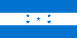
| Flag of Honduras | |
Honduras was home to several important Mesoamerican cultures, most notably the Maya, before the Spanish colonization in the sixteenth century. The Spanish introduced Catholicism and the now predominant Spanish language, along with numerous customs that have blended with the indigenous culture. Honduras became independent in 1821 and has since been a republic, although it has consistently endured much social strife and political instability, and remains one of the poorest countries in the Western Hemisphere. In 1960, the northern part of what was the Mosquito Coast was transferred from Nicaragua to Honduras by the International Court of Justice.
Currency / Language
| ISO | Currency | Symbol | Significant figures |
|---|---|---|---|
| HNL | Honduran lempira | L | 2 |
| ISO | Language |
|---|---|
| ES | Spanish language |


